Latest News
Facebook develops AI-powered population density maps of Africa

News Highlight
Facebook says the new artificial intelligence-powered high-resolution maps will boost the ability of humanitarian aid and relief agencies to assist people in need.
Facebook is partnering non-profits and research organisations, including the Columbia University’s Center for International Earth Science Information (CIESIN), to create detailed population density maps of Africa. The new artificial intelligence-powered high-resolution maps will boost the ability of humanitarian aid and relief agencies to assist people in need.
Using artificial intelligence (AI) and big data, Facebook is addressing the large-scale social, health and infrastructure challenges in Sub-Saharan Africa (SSA). The social networking service company says it is leveraging its expertise in data science, AI and machine learning to create detailed and accurate maps of local populations.
According to a statement released by Facebook on Tuesday, the Missing Maps Project in Malawi used these AI-powered maps to filter out 97 per cent of the terrain that is uninhabited. This helped to coordinate the activities of the 3,000 Red Cross volunteers in Malawi who visited up to 100,000 houses, educating people about measles and rubella vaccines.
In addition to assisting the Red Cross and Missing Maps Project in Malawi, the maps have also been used by other organisations such as the Bill and Melinda Gates Foundation, the World Bank and the Humanitarian OpenStreetMap, as well as in Tanzania to kick-start renewable electrification efforts to rural areas.
The Facebook team is using AI to efficiently crunch through data at a petabyte scale. Without the power of AI, the company said this would have required countless hours for volunteers to comb through millions of square miles of pictures to identify which contained a tiny town or remote village.
In Africa, the team found approximately 110 million buildings in just few days of examining 11.5 billion individual images to ascertain if they contained buildings. In partnership with CIESIN, Facebook ensures that the maps use the best available administrative data for all countries involved. The Facebook population density maps project now aims to keep adding new countries and continents.
“Having started my career at USAID (United States Agency for International Development) working on malaria control, I have witnessed first-hand the critical role that accurate data plays in the effectiveness of humanitarian efforts,” said Laura McGorman, a public policy manager at Facebook. “What is exciting about projects like these is that they provide an opportunity for our company to contribute to these efforts through our expertise in data and machine learning.”
According to Facebook, the social media giant started developing population density maps to provide better tools to support connectivity efforts around the world. Addressing privacy concerns, Facebook said no data of its users has been or will be used in the project and the census and satellite data used contain no personally-identifiable information.
Related News
-
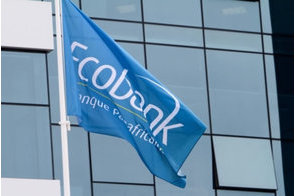
Ecobank signs $200 million sustainability-linked loan agreement
Ecobank said the loan is a significant milestone as it is the first ever sustainability-linked loan to a sub-Saharan African ...
-
ILO Director-General advocates for elimination of gender-based violence
“Violence and harassment against women and girls know no borders, not even the workplace,” said the DG of the United ...
-
Group to Create $20 billion value chain for sustainable farming
Food systems account for more than 30% of global emissions and are critical in achieving the Paris Agreement and limiting global ...
Latest Blogs
- AML/CFT regulations and data protection require balance in regulating cryptocurrency
- It's time for honest discussions on Nigeria's security architecture
- Driving economic growth through green transition in Nigeria
- CBN is fighting inflation instead of stagflation
- Why electricity privatization failed (2)
Most Popular News
- IFC, partners back Indorama in Nigeria with $1.25 billion for fertiliser export
- CBN increases capital requirements of banks, gives 24 months for compliance
- Univercells signs MoU with FG on biopharmaceutical development in Nigeria
- CBN settles backlog of foreign exchange obligations
- Ali Pate to deliver keynote speech at NDFF 2024 Conference
- Euromonitor forecasts Sub-Saharan Africa GDP to grow to $4.5trn by 2040